A pattern change brings pleasant weekend weather

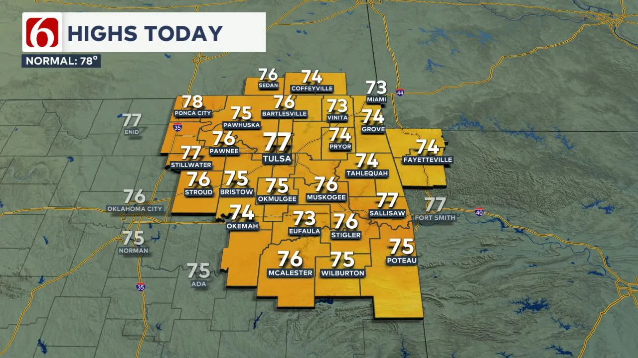
Mostly pleasant conditions are expected today as a mid-level trough slowly moves south of the area. A few spotty showers or storms may develop across extreme southern Oklahoma this afternoon and early evening. Partly cloudy skies will persist across northern Oklahoma early this morning before more sunshine arrives.  North winds at 10 to 20 m.p.h. will be noticeable, with daytime highs reaching the lower to mid-70s.
The Weekend Outlook
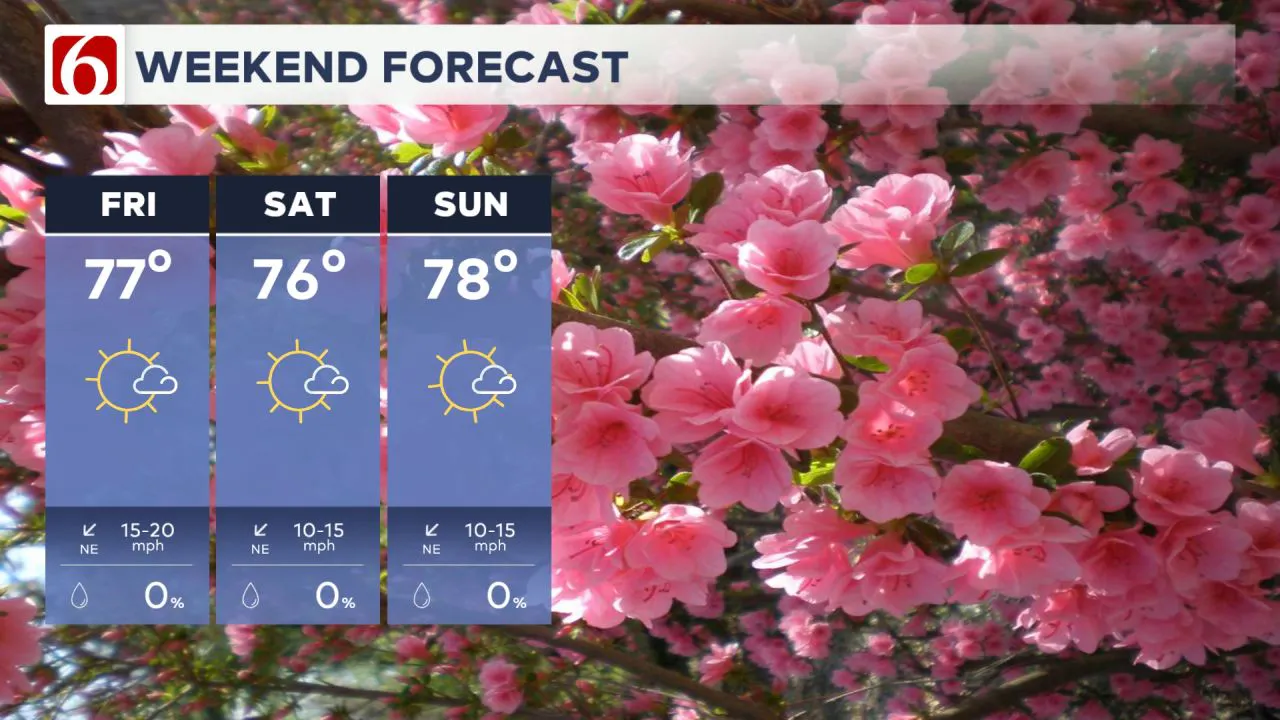
As the upper trough continues to shift away, a surface ridge of high pressure will build across the Missouri Valley and extend into northern Oklahoma this weekend. These features will bring pleasant weather conditions, with morning lows in the mid to upper 40s and daytime highs in the mid-70s on both days.  Sunshine will be abundant for most of the weekend, but a few clouds will near the eastern third of the area Sunday.
Slight Shower Chance Near State Line Monday
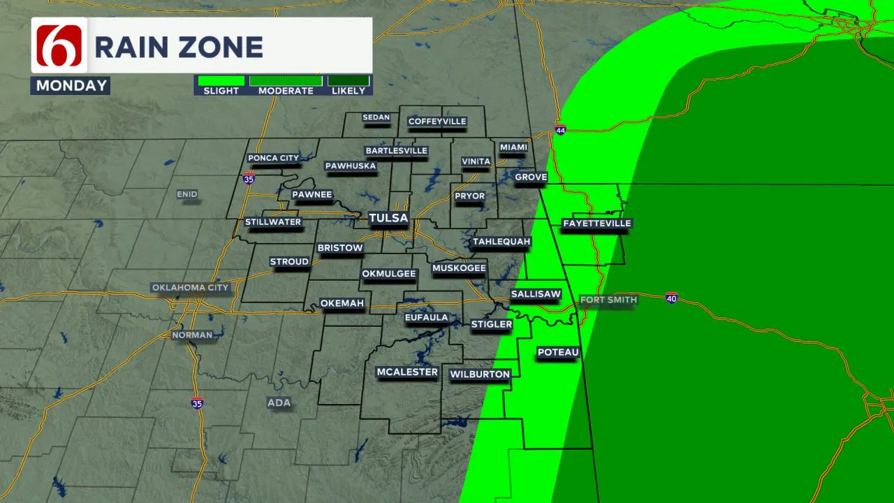
Early next week, the upper-air trough will move northeast, influencing the Ark-La-Tex region and western Arkansas.  This may bring a few spotty showers to western Arkansas on Monday afternoon and evening, with a slight chance of some lingering showers near the Oklahoma-Arkansas state line. However, most of the area will remain dry.
Warm, Breezy Weather Returns Next Week
A stronger disturbance developing in the western United States will lead to pressure falls near and east of the Rockies, causing gusty south winds to develop early next week. Warmer air aloft will move from the Mexican Plateau into the southern and central Plains, resulting in above-average temperatures. Additionally, increasing low-level moisture, combined with recent rainfall and evapotranspiration, may lead to slightly higher heat index values by midweek.
Temperatures Climb into the 80s and Near 90
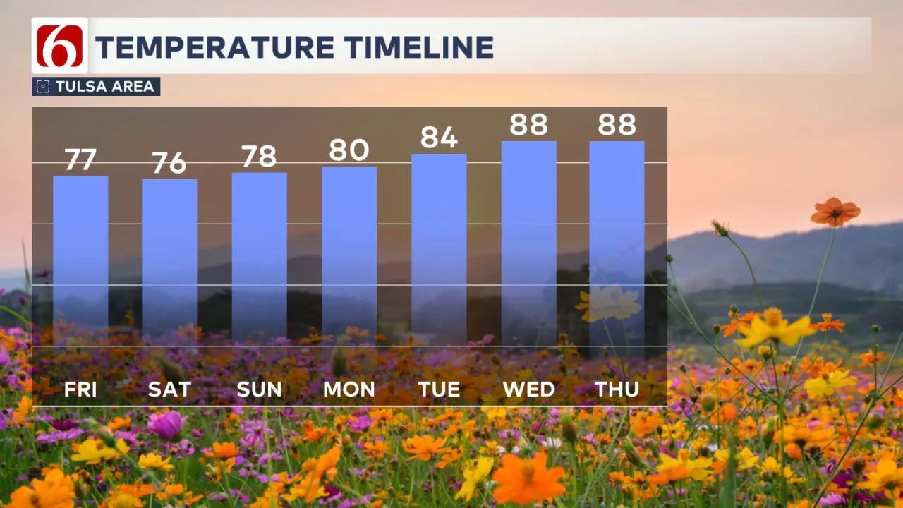
Monday afternoon highs will remain in the upper 70s, while Tuesday and Wednesday morning lows will be in the upper 50s to lower 60s. Highs on Tuesday will reach the mid-80s, and Wednesday will see highs in the upper 80s.  By midweek, heat index values may climb into the lower 90s.
Storm System Arrives Late Week
Late next week, a disturbance will approach from the southwest upper-air flow while a surface boundary moves from the central Plains into northern Oklahoma by Thursday night or Friday. While the exact outcome of this boundary remains uncertain, there will be a chance for showers and storms nearby. A higher probability scenario suggests that the boundary could stall across far northern Oklahoma late next week, coinciding with a stronger disturbance approaching from the southwest. This setup will increase the chances for thunderstorms on Friday and Saturday. Based on this pattern, the potential for strong to severe thunderstorms will be increasing late next week and into the weekend.
The Morning Weather Podcast:
The daily morning weather podcast briefing will remain on hold indefinitely due to ongoing internal workflow issues.
We're working to resolve these challenges as soon as possible and appreciate your patience. We apologize for the inconvenience and hope to be back soon. Thank you for your understanding.
-----
Need-to-know severe Oklahoma weather prep:
🔗Severe weather safety: what you need to know to prepare
🔗Tornado Watch vs. Tornado Warning: what they mean and what to do
🔗Severe weather safety: what to do before, during, and after a storm
🔗Why registering your storm shelter in Oklahoma could save your life
🔗Floodwater kills more Oklahomans than tornadoes in the last decade, here's why
🔗'Turn around, don't drown': Flood safety tips for Oklahomans
🔗5 things to know: How Oklahomans can get federal money to install storm shelters
🔗Breaking down the SoonerSafe Rebate Program: Do I qualify for a storm shelter?
Watch us on YouTube!
Follow NewsOn6 on X/Twitter for automated severe weather alert posts >>>>>> @NewsOn6

Emergency Info: Outages Across Oklahoma:
Northeast Oklahoma has various power companies and electric cooperatives, many of which have overlapping areas of coverage. Below is a link to various outage maps.
- PSO Outage Map
- OG&E Outage Map
- VVEC Outage Map
- Indian Electric Cooperative (IEC) Outage Map
- Oklahoma Association of Electric Cooperatives Outage Map — (Note: Several Smaller Co-ops Included)
Follow the News On 6 Meteorologists on Facebook!