Tulsa Weather: Heat stress gives way to increasing storm chances across Oklahoma for the weekend

Rain Gear This Weekend?
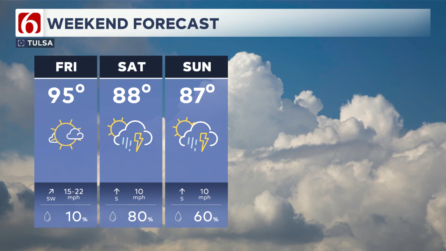
Yes, keep it handy. Have some indoor alternatives ready to go as you may be on the sidelines at times, waiting for storms to pass through the area. Despite the slightly cooler temperatures, heat index values will still be expected in the mid-90s.

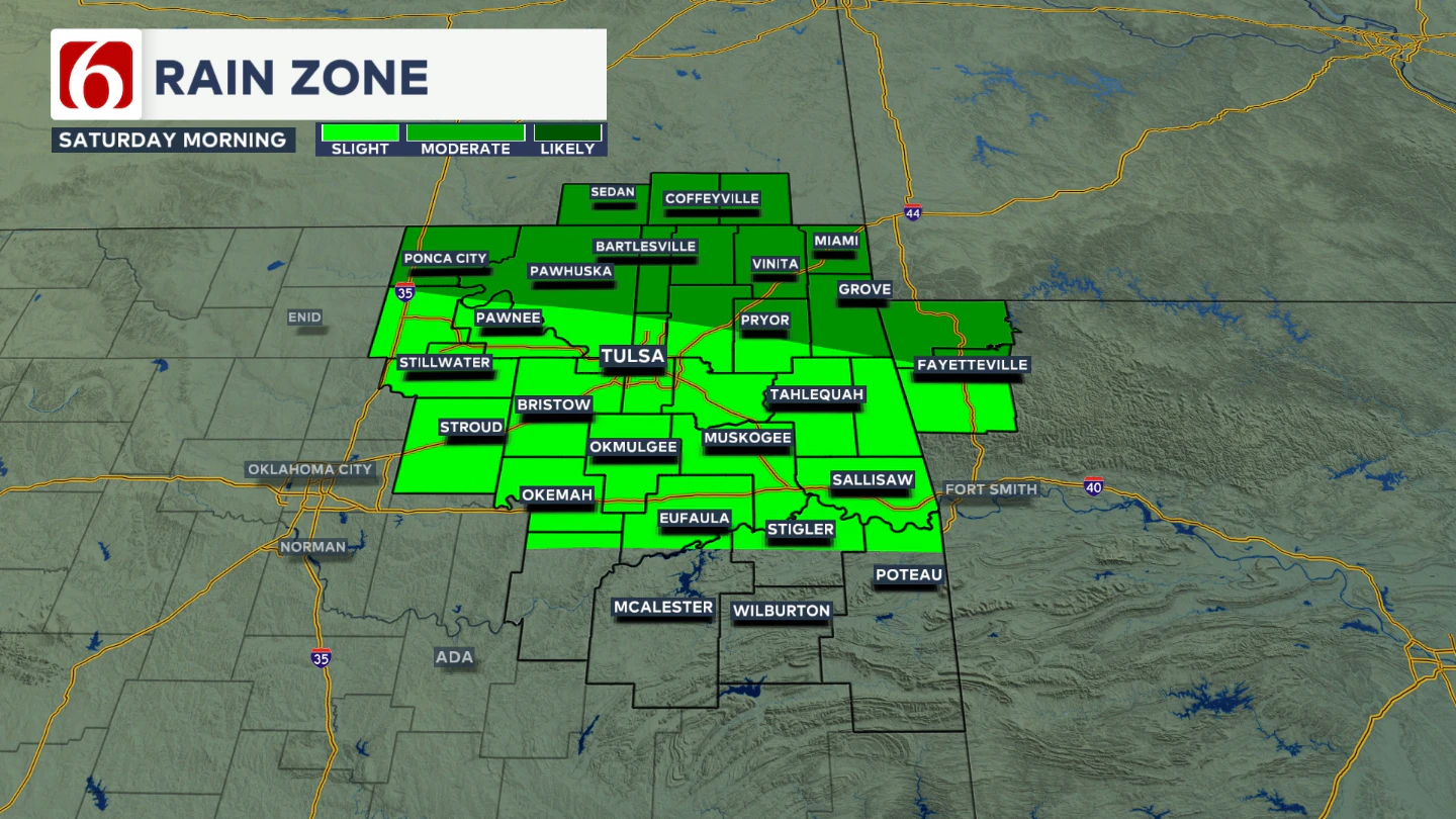
By early Saturday, a complex of storms across Kansas looks to be drifting south. How many of these storms reach northern Oklahoma and southeastern Kansas Saturday morning is uncertain, but at least some leftover storms will be a possibility in those areas Saturday morning and they would be slow-moving and locally quite heavy if they make it here.

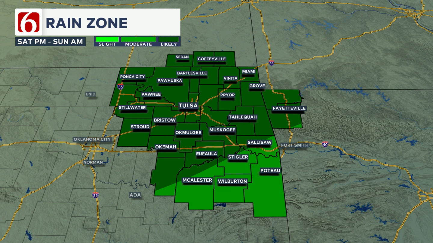
By Saturday afternoon and evening, a boundary is expected to be positioned across northern OK and will become more active, supporting more widespread thunderstorm development.
Some storms may become strong to severe, capable of producing damaging wind gusts and intense rainfall over a short period, raising the likelihood for localized flooding.

The exact timing is still a bit uncertain, but the greatest storm chances currently appear to be from the second half of Saturday into early Sunday morning across northern Oklahoma.
Additional scattered showers and storms are expected Sunday with the outflow nearby. Locally heavy rainfall and flash flooding will again be possible due to deep tropical moisture. Storm chances on Sunday may focus slightly more across southeastern Oklahoma.
Any Severe Threats?
While the severe threat remains low overall, a few storms could produce strong downburst winds capable of prompting brief severe thunderstorm warnings. And once again, the threat for localized flash flooding could quickly increase under the heaviest storms so remain very aware of that flooding threat.
Recreational Impacts
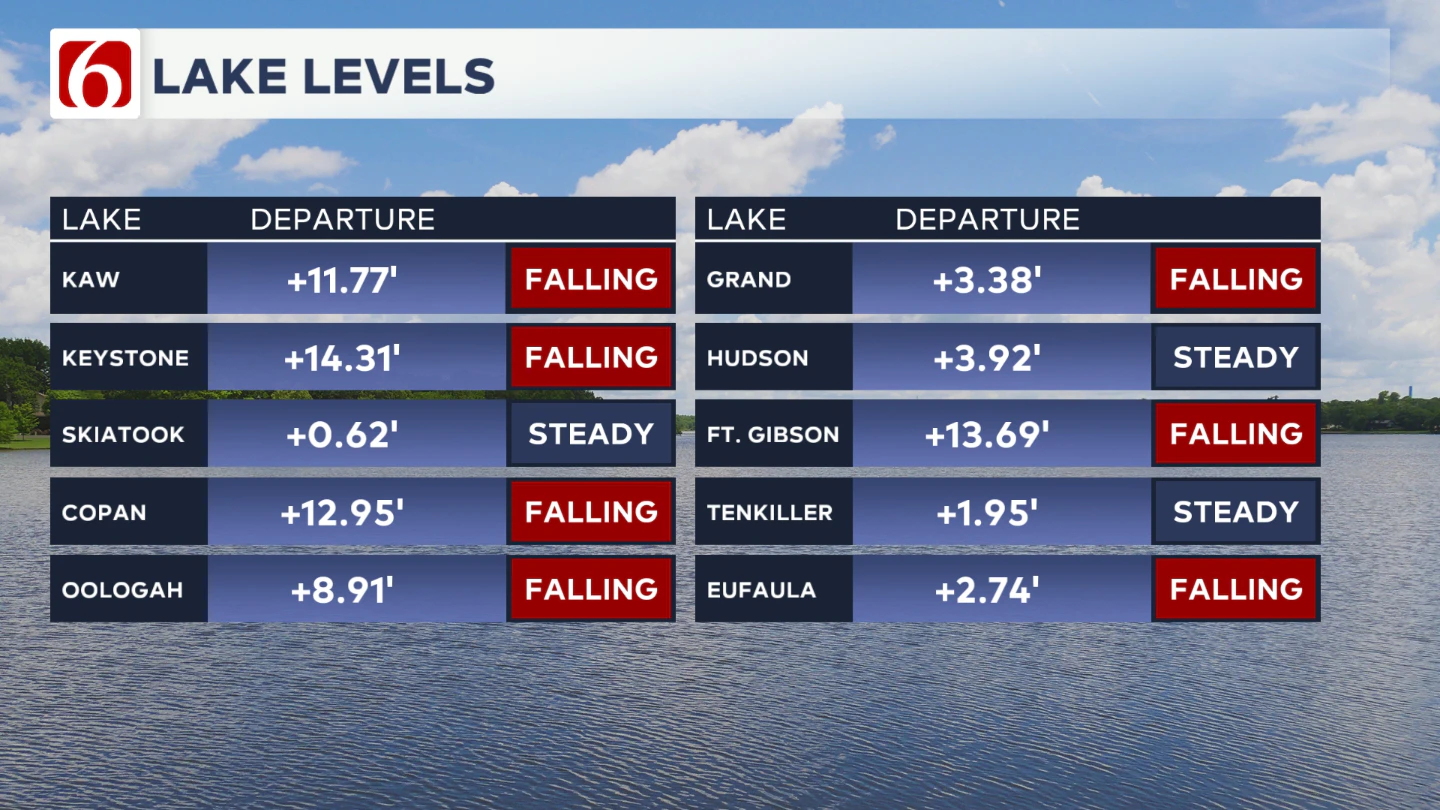
Area lake levels remain elevated, which could impact some recreational areas. Many lakes also have floating debris. Use extra caution on the water. Levels are slowly dropping, but will remain high for the upcoming week.

The Morning Weather Podcast:
The daily morning weather podcast briefing will remain on hold indefinitely due to ongoing internal workflow issues.
We're working to resolve these challenges as soon as possible and appreciate your patience. We apologize for the inconvenience and hope to be back soon. Thank you for your understanding.
Hot weather safety:
🔗Oklahoma heat safety tips: How to spot and prevent heat illness
🔗 Top summer safety tips every family needs to know
🔗 Swimming pools, splash pads & aquatic centers in Tulsa metro to stay cool
Need-to-know severe Oklahoma weather prep:
🔗Severe weather safety: what you need to know to prepare
🔗Tornado Watch vs. Tornado Warning: what they mean and what to do
🔗Severe weather safety: what to do before, during, and after a storm
🔗Why registering your storm shelter in Oklahoma could save your life
🔗Floodwater kills more Oklahomans than tornadoes in the last decade, here's why
🔗'Turn around, don't drown': Flood safety tips for Oklahomans
🔗5 things to know: How Oklahomans can get federal money to install storm shelters
🔗Breaking down the SoonerSafe Rebate Program: Do I qualify for a storm shelter?
Watch us on YouTube
Follow NewsOn6 on X/Twitter for automated severe weather alert posts: @NewsOn6
Emergency Info: Outages Across Oklahoma:
Northeast Oklahoma has various power companies and electric cooperatives, many of which have overlapping areas of coverage. Below is a link to various outage maps.
- PSO Outage Map
- OG&E Outage Map
- VVEC Outage Map
- Indian Electric Cooperative (IEC) Outage Map
- Oklahoma Association of Electric Cooperatives Outage Map — (Note: Several Smaller Co-ops Included)