Unseasonably Warm Now, But Storms and Cooler Air Are on the Way

The forecast is holding steady for the next few days as unseasonably warm weather continues for the entire region. A mid-level ridge of high pressure will remain the dominant feature in our weather pattern through Thursday.
This setup will keep showers and storms out of the area while maintaining above-normal temperatures throughout the week. A strong storm system begins to influence the weather pattern soon and will bring the threat of thunderstorms, some strong to severe, across part of the area Friday late into Saturday.
Temperatures from Wednesday through Friday will continue to run well above seasonal averages. A strong upper-level wave will eject across the Northern Rockies into the central and northern Plains Thursday night into Friday morning.
When will storms begin to develop?
Storm chances will ramp up late Friday night as a cold front and its associated upper-level trough approach the region. Current timing suggests most storms will develop after Friday night football games wrap up, though this could still shift slightly over the next few days.
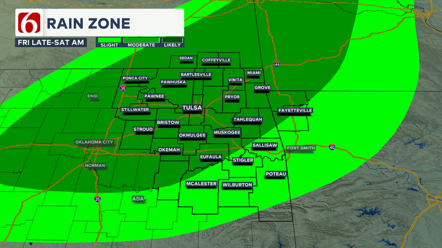
Where are the strongest storms likely to form?
Storms are expected to initiate along and just west of I-35 Friday night, then expand east and southeast overnight into early Saturday morning. Some of these storms may become strong to severe, with large hail and damaging winds as the primary threats.
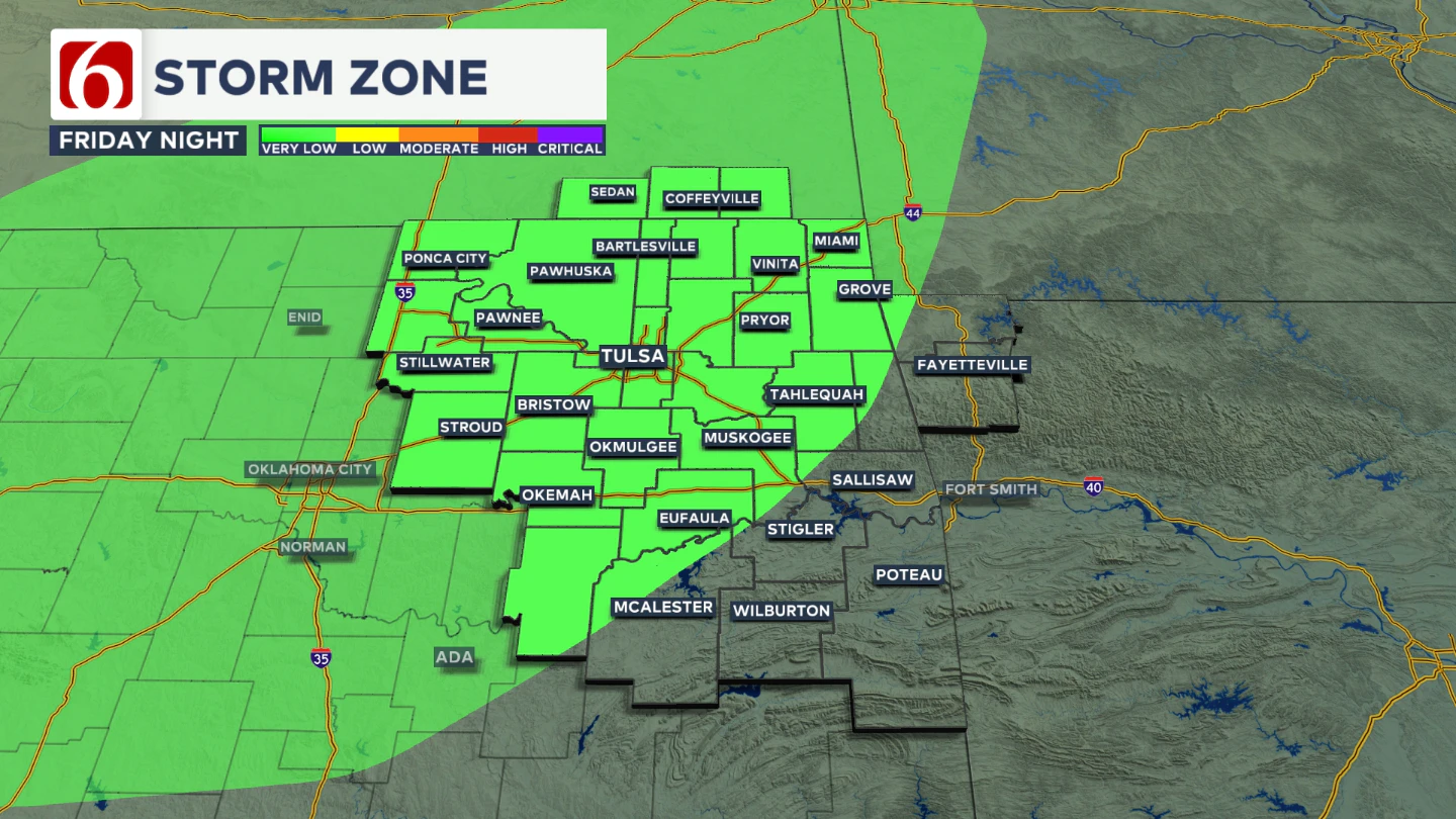
This is the current severe weather risk outlook for late Friday night into pre-dawn Saturday.
Could any storms turn severe?
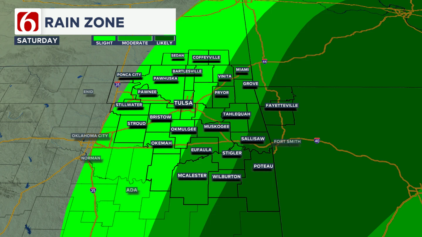
By early Saturday morning, showers and storms should be ongoing near and east of the Tulsa metro.
Areas along and south of I-40 and east of Highway 69 will have a brief window for additional surface-based storm development from morning through midday, before most activity exits into western Arkansas.
Despite the early timing, wind profiles could support severe weather.
Will additional storms develop later Saturday?
Later Saturday afternoon, more storms are likely to develop across parts of north Texas and spread into the ArkLaTex region, bringing another round of surface-based severe weather.
A few of these storms may reach far southeastern Oklahoma, possibly extending as far north as the Highway 270 corridor through Latimer and LeFlore counties. This is the current severe weather risk outlook for Saturday.
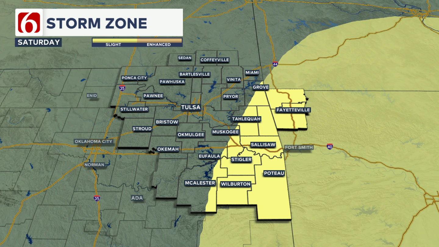
Some additional changes are still possible with this outlook between now and Saturday.
What happens after the front moves through?
Behind the departing front, cooler and drier air will filter into the region, stabilizing the atmosphere, including over the Tulsa metro by early afternoon into the evening.
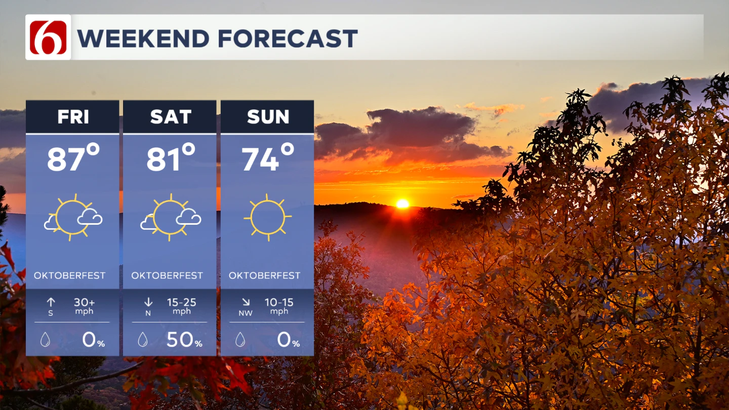
Storms are not expected in the metro after midday Saturday, even though a few showers may continue through early afternoon. Sunday brings a pleasant, one-day cooldown with north winds and highs in the 70s.
When will the next front arrive?
Temperatures will rebound into the lower to mid-80s Monday and Tuesday ahead of the next front, which is expected to move through Tuesday night into Wednesday.
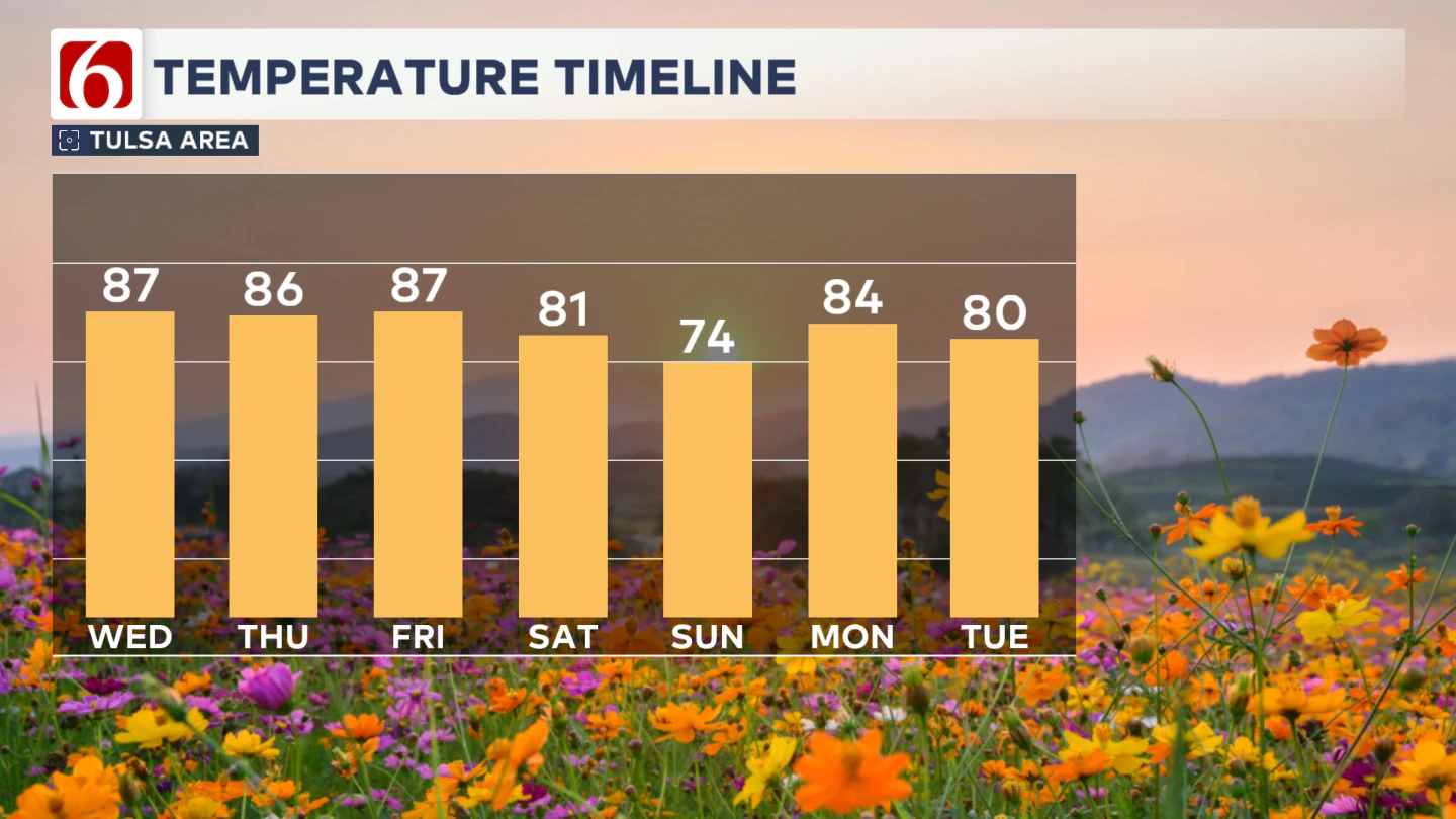
However, the airmass may not recover in time, and with limited low-level moisture, storm chances with the Tuesday front remain low.
Could rain chances return next week?
This front is expected to stall near the Red River Valley as another upper-level wave approaches by Wednesday and Thursday. Southerly flow will increase low-level moisture across at least the southern third of the state.
As a result, shower and storm chances will return to the forecast from Wednesday night into Thursday of next week.
College Football Forecast
The University of Tulsa Golden Hurricane travels to Greenville, North Carolina, for a Thursday night game against East Carolina University.
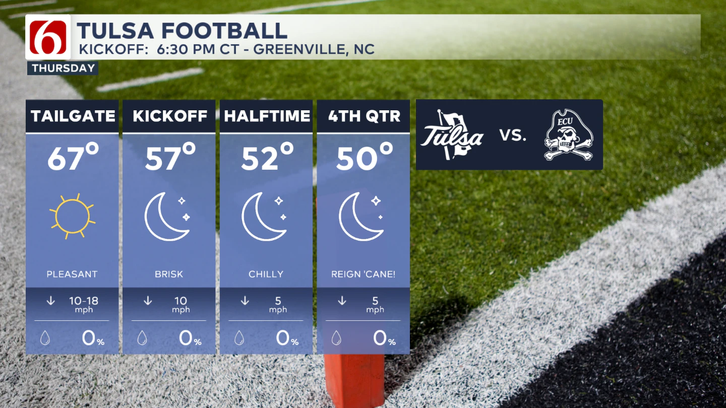
Game time is 6:30 pm and will feature a chilly forecast. If you’re going to the game, bring a jacket.
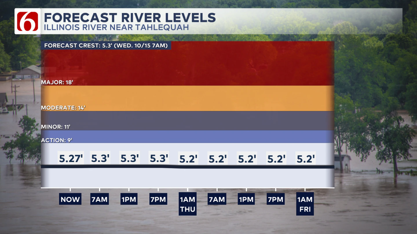
The Illinois River near Tahlequah
The Morning Weather Podcast:
The daily morning weather podcast briefing will remain on hold indefinitely due to ongoing internal workflow issues.
We're working to resolve these challenges as soon as possible and appreciate your patience. We apologize for the inconvenience and hope to be back soon. Thank you for your understanding.
Need-to-know severe Oklahoma weather prep:
🔗Severe weather safety: what you need to know to prepare
🔗Tornado Watch vs. Tornado Warning: what they mean and what to do
🔗Severe weather safety: what to do before, during, and after a storm
🔗Why registering your storm shelter in Oklahoma could save your life
🔗Floodwater kills more Oklahomans than tornadoes in the last decade, here's why
🔗'Turn around, don't drown': Flood safety tips for Oklahomans
🔗5 things to know: How Oklahomans can get federal money to install storm shelters
🔗Breaking down the SoonerSafe Rebate Program: Do I qualify for a storm shelter?
Watch us on YouTube
Follow NewsOn6 on X/Twitter for automated severe weather alert posts: @NewsOn6
Emergency Info: Outages Across Oklahoma:
Northeast Oklahoma has various power companies and electric cooperatives, many of which have overlapping areas of coverage. Below is a link to various outage maps.
- PSO Outage Map
- OG&E Outage Map
- VVEC Outage Map
- Indian Electric Cooperative (IEC) Outage Map
- Oklahoma Association of Electric Cooperatives Outage Map — (Note: Several Smaller Co-ops Included)