When Will Fall Temps Arrive? Storm Chances First, Cooldown Coming

The forecast is holding steady for the next few days as unseasonably warm weather continues for the entire region. A mid-level ridge of high pressure will remain the dominant feature in our weather pattern through Thursday.
This setup will keep showers and storms out of the area while maintaining above-normal temperatures throughout the week. A strong storm system begins to influence the weather pattern soon and will bring the threat of thunderstorms, some strong to severe, across part of the area Friday late into Saturday.
Temperatures from today through Friday will continue to run well above seasonal averages. 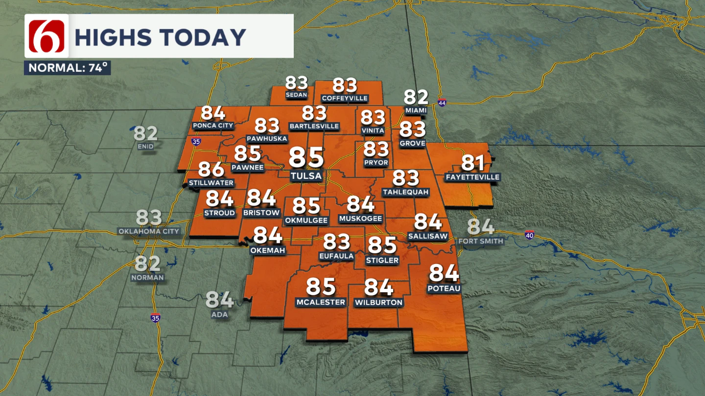 A strong upper-level wave will eject across the Northern Rockies into the central and northern Plains today, keeping showers and storms well north and northwest of Oklahoma. However, later tonight into early Friday morning, a few showers or storms may arrive across western Kansas and northwestern Oklahoma as the surface front begins to slide into these areas. These will continue to stay away from our area for most of Friday.
What about Friday?
Northeastern Oklahoma will remain on the eastern side of the developing system through most of Friday. The surface pressure gradient will increase, leading to gusty southeast winds from 15 to 30 mph. 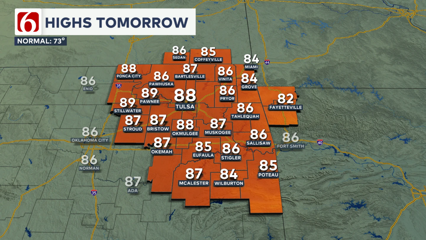 Expect a mix of sun and clouds with afternoon highs reaching the mid to upper 80s.
When will storms begin to develop?
Later Friday evening, mostly after midnight, as the low-level jet intensifies and another wave of instability rounds the base of the upper-level trough, scattered storms will develop near the advancing boundary.
A few of these storms could become strong to severe, with hail and damaging winds as the main threats. 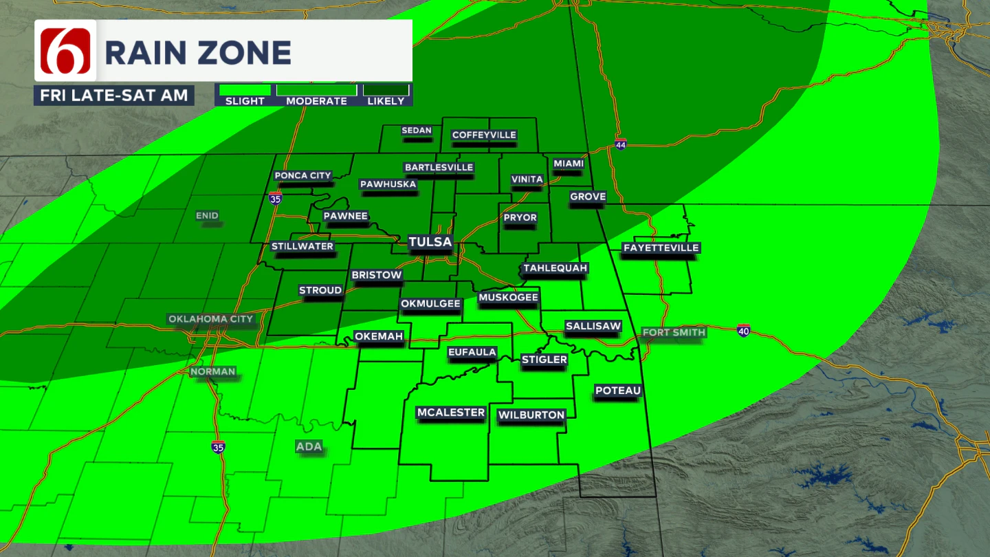 The highest chances for storms will be along and north of Highway 412 into southern Kansas. A few storms may extend farther south along the I-40 corridor before dawn Saturday, though the better chances remain slightly farther north.
 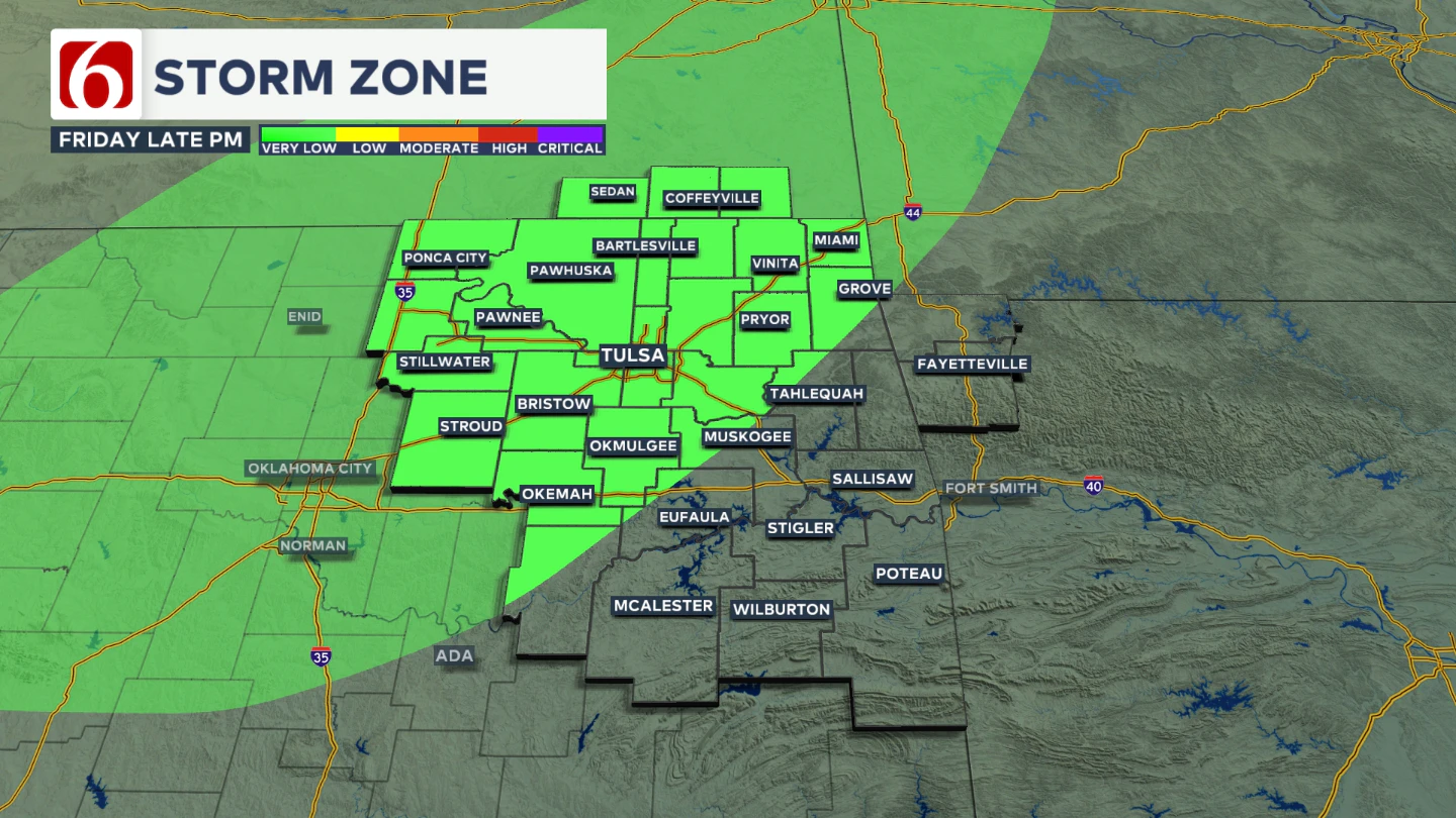 A few scattered storms will be in the forecast for this time, but not everyone will experience overnight storms.
What can we expect early Saturday morning?
Early Saturday morning, scattered showers and storms will be ongoing across parts of northeast Oklahoma and expanding into western Arkansas. 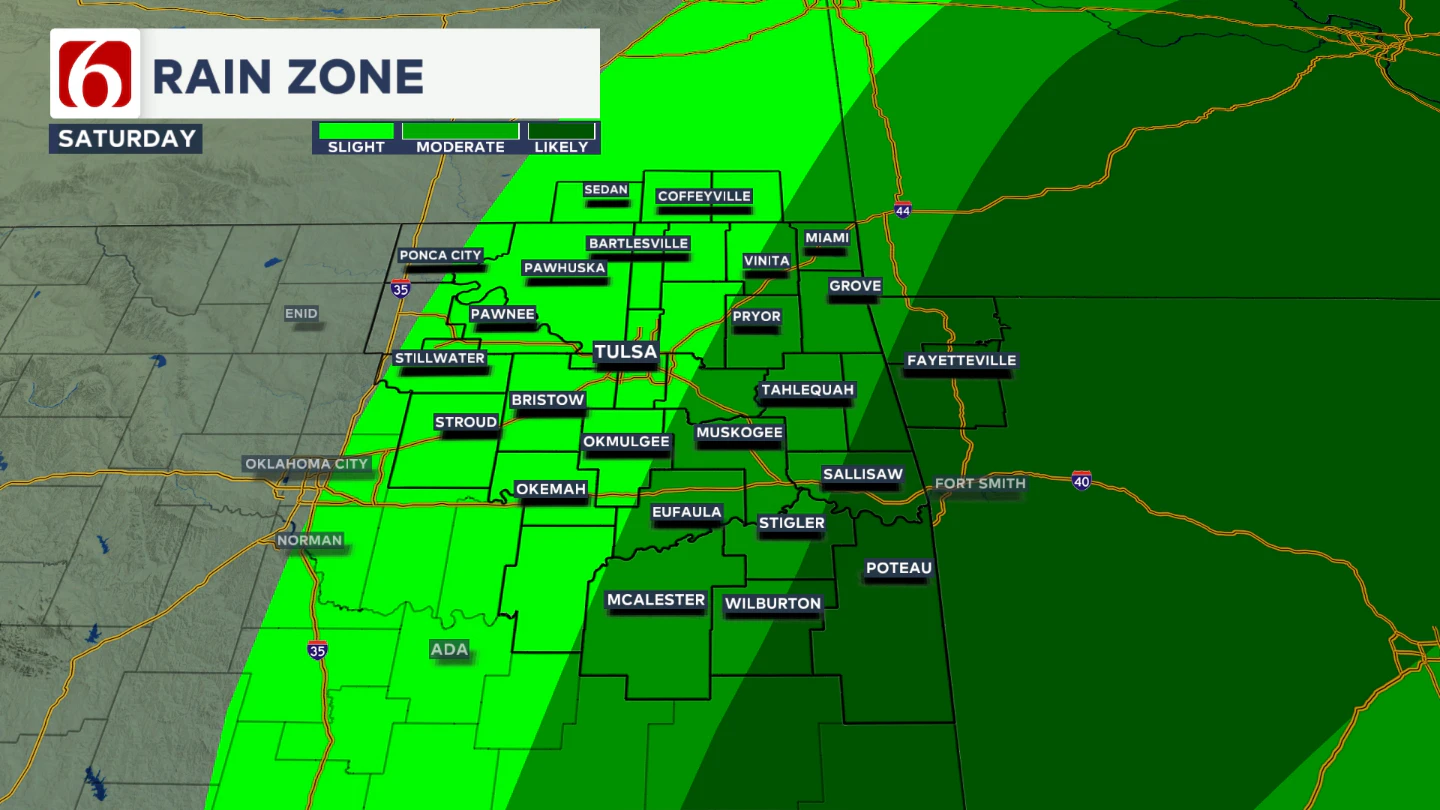 The surface boundary will continue advancing east and southeast through midday into early afternoon. During this time, additional scattered storms may develop along the boundary, with a higher potential for severe weather, including all modes. The timing of the morning storm exit will directly influence where and when this second round forms.
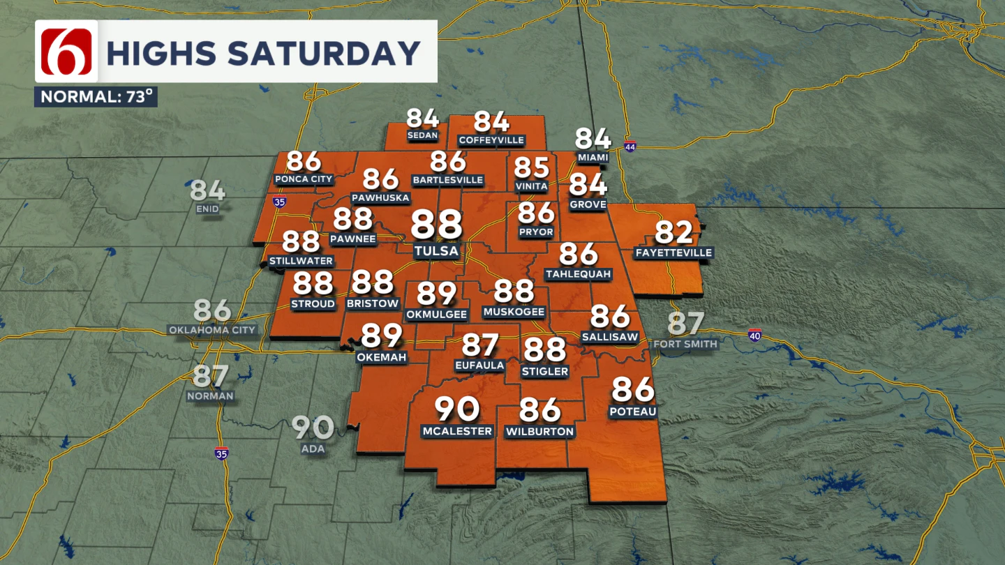
 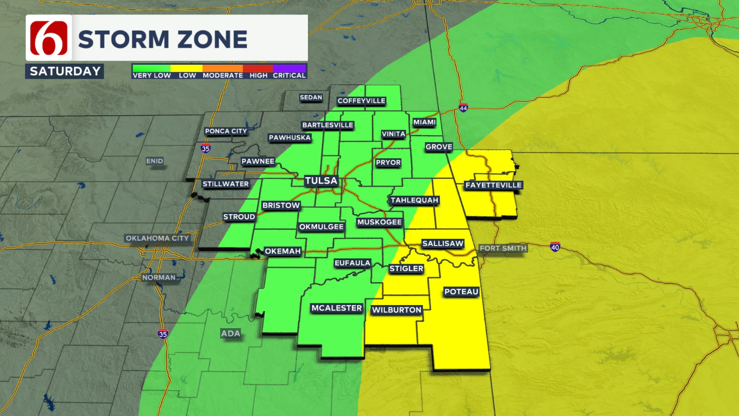 Most data suggests Saturday afternoon or early evening storms will focus along the Oklahoma-Arkansas state line, stretching from the Ark-La-Tex region northward into southwestern Missouri. Saturday afternoon highs may still reach into the mid to upper 80s before the front pushes through the entire area. This portion of the forecast may continue to change.
How does Saturday night look?
By Saturday evening, the main upper-level trough will be approaching the state. A few early evening showers could develop across northeastern Oklahoma, but the probability remains low.
When will fall weather return?
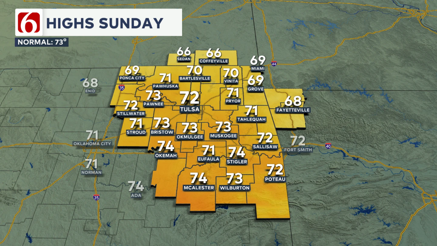
The front will sweep through late Saturday late afternoon, ushering in pleasant, fall-like weather for Sunday. Drier air and clear skies will allow morning lows to dip into the upper 40s in some northeastern Oklahoma valleys, with lower 50s expected in the Tulsa metro. 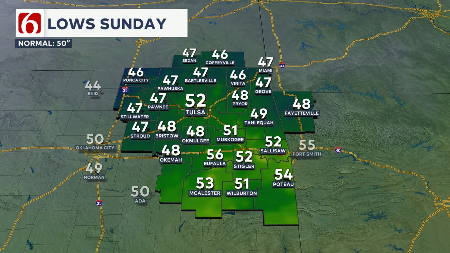 Northwest winds from 15 to 20 mph will help keep afternoon highs in the lower to mid 70s, near seasonal averages. Sunny conditions are expected Sunday.
What’s about next week?
Another strong upper-level trough will quickly develop to our west and pivot across the Central Plains early next week, bringing another cold front across Oklahoma on Tuesday.
Ahead of its arrival, gusty south winds will increase Monday, with speeds from 15 to 30 mph and highs climbing back into the lower to mid 80s. A few scattered showers may develop as low-leve
Could we see more storms Tuesday?
Currently, the forecast for Tuesday is mostly dry for our area. Tuesday morning, the strong front will move through the area. A few storms may develop Tuesday midday into afternoon where the front encounters deeper moisture.
Current data supports this setup along the Oklahoma-Arkansas state line, where a few strong to severe storms will be possible. Most ensemble guidance currently favors higher storm chances to our east.
After Monday, we expect near seasonal temperatures to remain for most of next week. 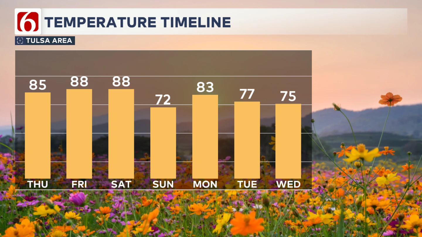
College Football Forecast
The University of Tulsa Golden Hurricane travels to Greenville, North Carolina, for a Thursday night game against East Carolina University.
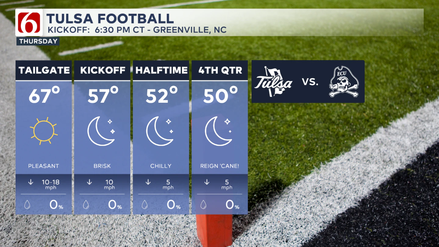
Game time is 6:30 pm and will feature a chilly forecast. If you’re going to the game, bring a jacket.
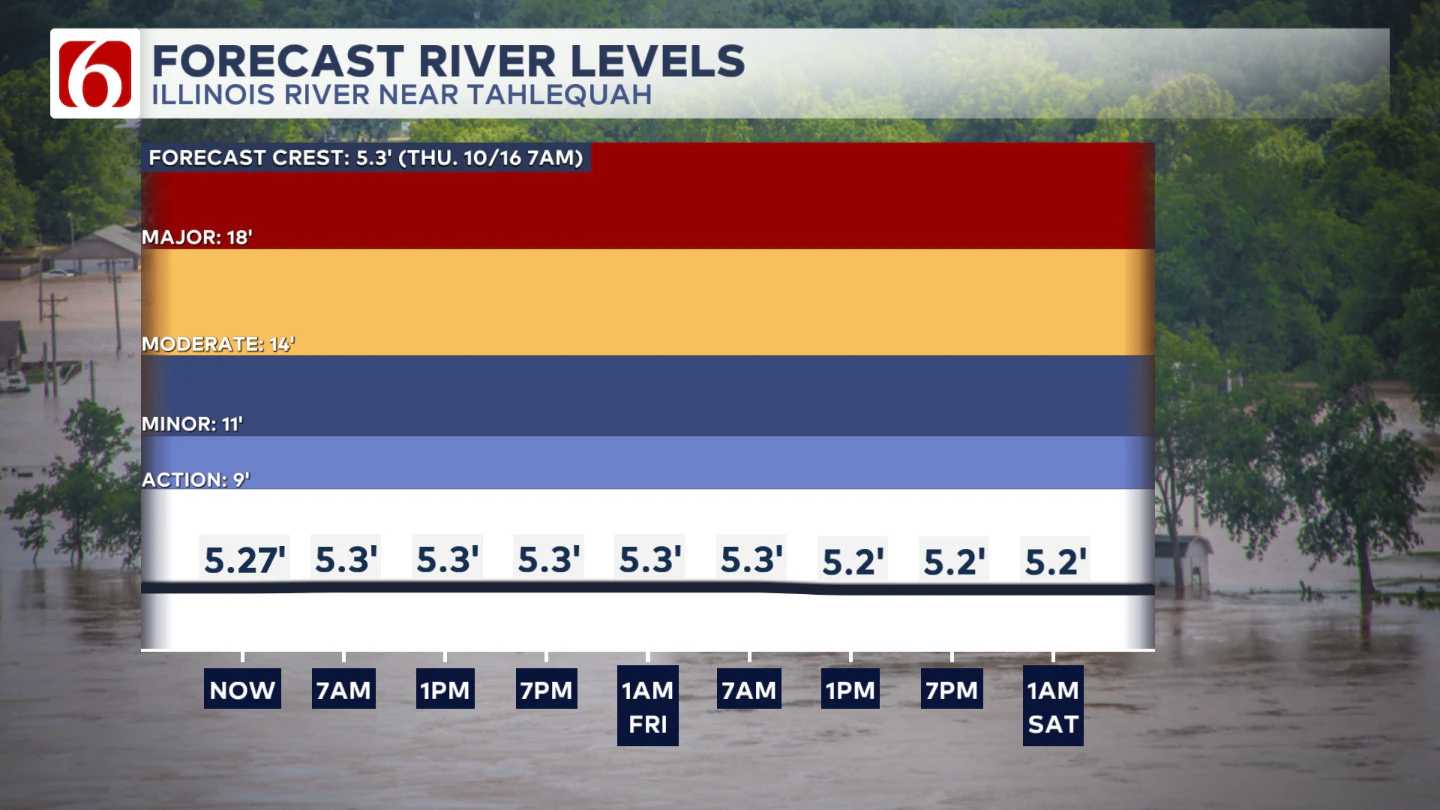
The Illinois River near Tahlequah
The Morning Weather Podcast:
The daily morning weather podcast briefing will remain on hold indefinitely due to ongoing internal workflow issues.
We're working to resolve these challenges as soon as possible and appreciate your patience. We apologize for the inconvenience and hope to be back soon. Thank you for your understanding.
Need-to-know severe Oklahoma weather prep:
🔗Severe weather safety: what you need to know to prepare
🔗Tornado Watch vs. Tornado Warning: what they mean and what to do
🔗Severe weather safety: what to do before, during, and after a storm
🔗Why registering your storm shelter in Oklahoma could save your life
🔗Floodwater kills more Oklahomans than tornadoes in the last decade, here's why
🔗'Turn around, don't drown': Flood safety tips for Oklahomans
🔗5 things to know: How Oklahomans can get federal money to install storm shelters
🔗Breaking down the SoonerSafe Rebate Program: Do I qualify for a storm shelter?
Watch us on YouTube
Follow NewsOn6 on X/Twitter for automated severe weather alert posts: @NewsOn6
Emergency Info: Outages Across Oklahoma:
Northeast Oklahoma has various power companies and electric cooperatives, many of which have overlapping areas of coverage. Below is a link to various outage maps.
- PSO Outage Map
- OG&E Outage Map
- VVEC Outage Map
- Indian Electric Cooperative (IEC) Outage Map
- Oklahoma Association of Electric Cooperatives Outage Map — (Note: Several Smaller Co-ops Included)